Saturday, August 25, 2012

Watching Isaac

TS Isaac weakened a bit and got a bit disorganized going over Haiti (probably a common problem if you drink the water) and still has to weather Cuba, but has lots of fuel in the form of bathtub-temperature water at its disposal after that. The maximum sustained winds are 70 mph which puts it just shy of a category one hurricane, but because of Cuba the strengthening to hurricane status will probably be put off a little longer.

The change from this morning's forecast is a projected strengthening to category two status before landfall. Speaking of landfall, I'm going to be watching this closely. We have an old family beach house at Indian Pass Beach (Between Apalachicola and Port St. Joe) and while it has withstood over a century of hurricanes, I always worry there will be one too many. The projected landfall is the western panhandle of Florida which would put Indian Pass in the dreaded northeast quadrant. The beach house would probably hold up fine under a category one (or two) hurricane but the northeast quadrant can also contain an inordinate number of tornadoes.


Friday, August 24, 2012

Isaac: The Storm

Every time I see an update on TS Isaac, I think of "Isaac's Storm"*, the Galveston Hurricane of 1900 that killed an estimated 6,000 to 12,000 people, (generally 8,000 officially accepted), the most of any hurricane to make landfall on the continental U.S. That hurricane, which occurred before the current system of naming hurricanes, made landfall on September 8th so we're not looking for any interesting coincidences.


File:1900 Galveston hurricane track.png

At the moment TS Isaac is following a similar path to the 1900 hurricane but is forecasted to turn north and possibly make landfall around the Florida panhandle instead of charging straight through the Gulf toward Texas.


I'll be keeping an eye on Isaac. If landfall is made too far to the east, we won't even get any rain out of it. Some of the people who really need the rain (i.e. Georgia) will get it, but others (the central states) probably won't be affected in the least. 

US Drought Monitor, August 21, 2012

*Named after the resident meteorologist, Isaac Cline. See the book of the same name.

Sunday, August 5, 2012

Early in the Hurricane Season but Already Needing a Recap

The northern Gulf of Mexico has been a ho-hum-ish place this summer but it's still very early in the season and things are bound to start getting more interesting. The activity has primarily involved Florida up through South Carolina.

T.S. Ernesto, heading through the eastern Caribbean initially looked promising for a situation that would affect my area personally (S. MS) but has taken a southern turn and will probably affect the Yucatan peninsula instead. Of course, model predictions are only as good as the information they're fed and are not infallible in any case, so we'll just keep an eye on it. Even if it restricts itself to the southernmost parts of the Gulf it will affect the surf in the rest of the Gulf so people living on the coast will notice a difference.

T.S. Florence is way out there in the eastern Atlantic but is a more organized storm than Ernesto at the moment. It looks like it probably won't even make it into the Gulf but head up the Eastern Seaboard instead. so will be slightly less interesting from my personal point of view.

A brief look at the summer season so far (since I've been such a lazy bum):

T.S. Alberto: [May 19-22] Formed off the SE coast of TX and stayed offshore. 23rd  pre-June named Atlantic Basin storm on record since 1851. Other than some rain, little impact on land.

T.S. Beryl: [May 25-30] Ruined Memorial Day weekend for many on the SE US coast. Wandered around before finally making landfall as the strongest tropical storm to hit the US mainland before June 1st. Several inches of rain, wind and downed trees (and powerlines) were the result of its march through Georgia and South Carolina before it surrendered.

Hurricane Chris: [June 19-22] (from the Weather Channel:) "While Chris was no threat to land, it became the 2012 Atlantic season's first hurricane on June 21, at a latitude of roughly 41 degrees north, no less! Only one other time on record during the month of June was an Atlantic hurricane farther north than Chris. You'd have to go all the way back to 1893, when a hurricane in post-analysis made it as far as 44 degrees north latitude, just south of the coast of Newfoundland! Only twice before in history (1887 and 1959) has the third storm of the season formed earlier than Chris." Chris never impacted land but made a semi-circle in the North Atlantic.

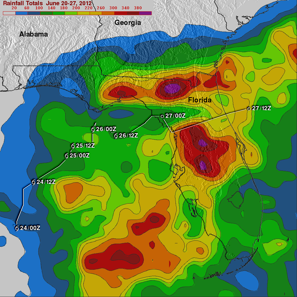
T.S. Debby: [June 23-27] The average date for the formation of the season's 4th named storm is August 23rd. Note that we're already on our sixth named storm and it's only August 5th! Debbie was primarily a rain event which sounds rather boring until you realize that it was a LOT of rain.  Look at the NASA map below to see some of the cumulative rainfall amounts. The most was an unofficial report of 28 inches in Wakulla County, FL.


There were also 21 tornadoes associated with Debby, with one fatality reported from an EF2.

Friday, August 3, 2012

Explanation of Humidity and Dew Point

I found this heat index chart online. For people who live elsewhere than in the more hot and humid areas of the U.S., it can be hard to convey just how awful the day is going to be when the humidity is 88% and the temperature is 82F at 7:30 in the morning.


For the past month (July) our average dew point was 72 degrees. The high was 79 and the low was 60. The low dew point seems to have occurred on two different days at the beginning of the month, but other than those two days, the dew point did not dip below 70.

I think this is just one of those worthwhile things to know and understand so I'm going to brave the crickets chirping in the deadly silence after this post and go ahead and do a public service announcement. Stick with me if you can.

From Wikipedia:
The dew point is the temperature below which the water vapor in a volume of humid air at a constant barometric pressure will condense into liquid water. Condensed water is called dew when it forms on a solid surface.

The dew point is a water-to-air saturation temperature. The dew point is associated with relative humidity. A high relative humidity indicates that the dew point is closer to the current air temperature. Relative humidity of 100% indicates the dew point is equal to the current temperature and that the air is maximally saturated with water. When the dew point remains constant and temperature increases, relative humidity decreases.
 Everyone knows what dew is: when you run out to get the paper in the morning and the grass is all wet, that's dew. When there's enough water in the air and the temperature gets just low enough, it forms. Obviously, if the temperature at which it will form (the dew point) is high, that means two things: it's pretty darn hot and it's pretty darn humid. Numbers are just abstract things though, so I provided the nifty chart above.

"So what?" you may be thinking. "It's the heat that will get to you, right?" Well, yes, heat certainly plays a part, but what cools you off in the heat? Evaporation. Water vapor has more energy than liquid water. As sweat evaporates, in other words, turns from a liquid into a gas, it absorbs heat and you feel cooler. You feel the opposite when you stick your hand over some steam. As the water vapor condenses back into liquid water on your hand it releases heat and you get a steam burn. The drier the air is (the lower the humidity) the more "room" there is for water to evaporate. If you stick a bone-dry sponge near some water it will suck it up immediately. So when the air is dry sweat evaporates quickly and you lose the heat to evaporation.

But what if it's humid? Humidity is like measuring the amount of water already in the sponge. The more water the sponge contains, the less water it can absorb. Saturation occurs when the sponge can't absorb one more drop of water. If you stick a saturated sponge in a puddle of water, the two just sit there. There's no more room in the sponge for any of the water. The weather men on TV don't just talk about humidity though - they talk about relative humidity. Remember when I said that humidity is like measuring the water in the sponge? Well, one thing you have to know is that the warmer the sponge, the more water it can absorb. (This metaphor starts to break down a bit here because that doesn't actually happen with the sponge...I think.) So the warmer the air, the more water vapor it can hold.

The practical application to this is watching what happens when you are outside on a hot day with high dew points. You exercise, your body sweats to try to cool you off...and the sweat just sits there. You find yourself wiping it out of your eyes, your clothes are wet, etc. The air simply can't hold any more water. You can't cool off because you can't use evaporation to remove heat from your body. One thing that helps evaporation is wind so if it's a breezy day you will lose a little more heat than you would have without it. Otherwise, you're going to feel pretty icky.

All that is just to say that I can't wait for fall because these morning and evening walks with dew points of 79 and 80 are not fun.

Monday, July 23, 2012

new book!

Just got a new book in the mail: Great British Weather Disasters. Most of my books cover American storms and such (except for one Canadian and some general books) so it will be nice to read this one. Plus, it's wonderful to have a new book no matter what!

source

Wednesday, July 18, 2012

Sunset

Some storms in the area but they are very persistently avoiding our house. The sunset was quite lovely though, despite the poor situation of the house.


Saturday, July 14, 2012

More clouds...

Some more photographs of clouds from our trip. The last two shots were taken this morning.


Thursday, July 12, 2012

Cloud-Watching at the Beach

There have been some lovely clouds here while we've been at the beach (AL coast).

First day we were here. I hadn't allowed the camera to fully acclimate.


Cumulonimbus over Mobile Bay

This shower actually caught up to us before we got inside.

Love the contrast. We had a lot of rain off and on the beginning of the week.

shower looking north over Mobile Bay

lovely mackerel sky

Not that this has anything to do with meteorology, but it's my blog and I can put whatever I want on it: I was very disappointed the first few nights we were here were so cloudy. I had brought my binoculars (very nice ones) and star charts so I could take advantage of the low light pollution. The last two nights, however, were very clear and I was able to see quite a lot. Sagittarius is prominently in the south and it's a busy area. Lots of open and globular clusters, several nebulae and just generally a lot of stars (right in the Milky Way). I saw the Lagoon Nebula and M22 for the first time. (;

Sunday, June 24, 2012

Storms at Indian Pass Beach

Long time no post! The weather here has been pretty nearly uniformly hot and mostly humid. Now and again we'll get a little much-needed rain. The showers are all scattered so it's terribly hit-and-miss, some areas getting dumped on and others still parching. Luckily we've had just enough (although if I don't water the flowers daily they scream and die).

However, there is something in the offing in the Gulf: TS Debby. I admit I've been preoccupied and only learned of its existence yesterday (not watching the news will do wonders for your peace of mind but you do tend to get caught off guard by some things). My parents sent me a link to some pictures from Apalachicola and Indian Pass. Here's one:

(source)

It's a little hard to tell, but this is the road leading from Indian Pass Road out to Florida State Road 30A. You can't see it, but McNeil's is in the distance at the end of the road. Here's what it looks like when tropical storms aren't hanging around:


See that little building in the distance? That's McNeil's, also known (now) as the Indian Pass Raw Bar. When I was little we called it the "Little Store" because (1) it was little and (2) it was the only store anywhere near. It was rather like an old-fashioned general store but without the charm. Mom wouldn't get any groceries but emergency ones there because she said they cost too much. We got groceries in either Apalachicola or Port St. Joe. But I digress.

Below is a map of that part of Indian Pass. The junction at the top of the picture is McNeil's and I've drawn an arrow pointing to the approximate site where the photos were taken, looking north. Obviously this satellite photo was taken during a drought. The lagoon is to the right and the Gulf is to the south, just beyond the driveways you can see in the picture.


The houses, at least the old ones which have been there for over a century, are on a ridge down the back of the little peninsula called Indian Pass. The Pass itself is at the very east end, between Indian Pass Beach and St. Vincent Island, a wildlife preserve. Deer have been known to swim across but I suppose most that try don't make it. The current is pretty strong and there are a lot of sharks. Oof.

Back to the houses. As I said, the houses are all on a ridge on the north side of Indian Pass Road. Across the street is an expanse of sea grass, sea oats, scrubby pines and palms and then the beach. New houses have been built on the lower area between the road and the beach. This seems very foolish to me. The old folks were much wiser. Not only did they build their beach houses on the ridge, but most of them were built just behind the crest so that the wind coming up from the water would be somewhat deflected up the slope and over the roof and not hit the house so directly. All of us owned "from water to water", that is, from the lagoon to the Gulf. The ground sloped down to sea-level behind the houses pretty rapidly and many people had little docks where fishing or crabbing could be done or a boat could be tied. The bottom was pretty shallow and one could go out castnetting for mullet.


When I was a child we used to spend a month or more every summer living at the beach. The beach house itself is another story. We always knew that you oughtn't hunker down in place to weather a hurricane because the road was so low that you'd be cut off almost immediately. After one hurricane (and I can't remember which one - they tend to run together when you live in Florida) I drove down there with my father to check on the house. When we drove up the oyster shell driveway there was a debris line half-way up which showed us the high-water mark. I turned around at that point and looked out the Gulf, lying calmly in its usual spot, and tried to imagine breakers crashing over the palm trees and our house on an island. My nightmares of being trapped at the beach house during a hurricane started from that point. Believe it or not, while the details sometimes change, I still have those nightmares. It's a very vivid thing when you actually see it.


Tuesday, May 1, 2012

Cloud photos from the air

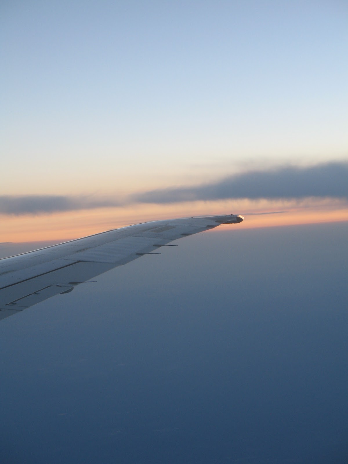
I took a week's retreat in PA and took some nifty cloud shots from the air, coming and going. I'm not going to try to stick labels on anything, just enjoy: